Devoir de Philosophie

South America - geography.

Publié le 26/05/2013

Extrait du document

South America - geography. I INTRODUCTION Alpacas Alpacas live in meadows, marshes, and grasslands of the Andes Mountains of Bolivia and Peru. The alpaca, which is closely related to the llama, is a domesticated type of the wild South American guanaco. The alpaca is raised for its fine wool, which is woven into sweaters, hats, and other items. W. H. Hodge/Peter Arnold, Inc. - geography. South America, fourth largest of the Earth's seven continents (after Asia, Africa, and North America), occupying 17,820,900 sq km (6,880,700 sq mi), or 12 percent of the Earth's land surface. It lies astride the equator and tropic of Capricorn and is joined by the Isthmus of Panama, on the north, to Central and North America. The continent extends 7,400 km (4,600 mi) from the Caribbean Sea on the north to Cape Horn on the south, and its maximum width, between Ponta do Seixas, on Brazil's Atlantic coast, and Punta Pariñas, on Peru's Pacific coast, is 5,160 km (3,210 mi). Countries of South America The South American continent represents 12 percent of the Earth's land surface, but is populated by only 6 percent of the Earth's population. Extensive mountain ranges and massive tracts of rain forest inhibit settlement in large regions of the continent. © Microsoft Corporation. All Rights Reserved. South America has a 2008 estimated population of 384 million, or 6 percent of the world's people. The continent comprises 12 nations. Ten of the countries are Latin: Argentina, Bolivia, Brazil, Chile, Colombia, Ecuador, Paraguay, Peru, Uruguay, and Venezuela. Two of the nations are former dependencies: Guyana, of the United Kingdom, and Suriname, of The Netherlands. South America also includes French Guiana, an overseas department of France. Located at great distances from the continent in the Pacific Ocean are several territories of South American republics: the Juan Fernández Islands and Easter Island (Chile) and the Galápagos Islands (Ecuador). Nearer the coast, in the Atlantic Ocean, is the Fernando de Noronha Archipelago, which is a Brazilian territory, and, farther south, the British dependency of the Falkland Islands, which is claimed by Argentina as the Islas Malvinas. The coastline of South America is relatively regular except in the extreme south and southwest, where it is indented by numerous fjords. II THE NATURAL ENVIRONMENT South America consists of four upland provinces, extending inland from the coasts, and, between them, three lowland provinces. The northern and western fringes are dominated by the Andes Mountains, the second highest mountain range in the world. Most of the eastern coast is fringed by the broader--and generally less elevated--highland areas of the Guiana and Brazilian massifs and the Patagonian Plateau. The main lowland is the vast Amazon Basin in the equatorial part of the continent; it is drained by the Amazon River, the world's second longest river. The Orinoco River drains a lowland in the north; to the south lies the Paraguay-Paraná basin. The lowest point in South America (40 m/ 131 ft below sea level) is on Península Valdés in eastern Argentina, and the greatest elevation (6,960 m/22,834 ft) is atop Aconcagua in western Argentina, the highest peak in the Western Hemisphere. A Geological History The oldest and most stable structural element of the continent is the shield area of the Brazilian and Guiana highlands of the east and northeast. It comprises a Precambrian (before 570 million years ago) complex of igneous and metamorphic rocks. In most places the shield is overlaid by sedimentary rocks, mostly of Paleozoic age (570 million to 225 million years ago), although some areas of younger basalts occur, notably in southern Brazil. Fossils found in the Brazilian Highlands offer evidence of continental drift, indicating that in the Permian period the continent was linked to Gondwanaland, a great landmass incorporating Africa and Asia. The complex that underlies the Patagonian Plateau is largely mantled by sediments deposited in the Mesozoic Era (225 million to 65 million years ago) and Tertiary Period (65 million to 1.6 million years ago) and by basalts of recent formation. Material eroded from the old shield areas contributed to the thick deposits of sediments in the surrounding seas. These sedimentary formations were uplifted repeatedly in the Mesozoic Era to form the coast ranges of Chile and southern Peru and the higher and more extensive Andes. This mountain-building process, which continued through the Tertiary Period, was accompanied by intrusions of magma (molten rock) and by the formation of volcanoes. Volcanic and seismic activity continues all up and down the continent's western rim. The glaciers of the southernmost Andes are remnants of the great ages of glaciation of the Quaternary Period (beginning 2.5 million years ago). The erosion of the highlands continues to contribute sediments to surrounding lowlands. B Natural Regions Tierra del Fuego, Argentina Ushuaia, on Argentina's island of Tierra del Fuego, is the world's southernmost city. Argentina claims part of the Tierra del Fuego archipelago, including the largest island, known as Tierra del Fuego or Great Island, and Staten Island. Chile claims the remainder of the islands in the territory. R. Van Nostrand/Photo Researchers, Inc. Rising abruptly from the northwestern and western coasts of the continent are the Andes. They consist of a single chain in Venezuela, in the north, and through much of Chile and Argentina, in the south, but the central part of the mountain system consists of two or three parallel axes of mountains, known as cordilleras, or ranges. In southwestern Bolivia and southern Peru, a region of large intermontane plateaus called the Altiplano separates the ranges. In Peru and Argentina the ranges are separated by relatively narrow but deep valleys. Among the two dozen peaks that exceed an elevation of 17,000 ft (equivalent to 5,182 m) are a number of active volcanoes located in south central Chile, southern Peru and Bolivia, and Ecuador. Altiplano Llamas serve as pack animals in the Altiplano, a high, treeless plateau stretching from southwestern Bolivia to southern Peru. Louis Audoubert/Scope The vast uplands of Guiana, in the northeast, and of Brazil, in the east, have rolling to hilly surfaces, with broad plateaus and high mesas. The plateaus are higher and less broad in the highlands of Guiana. In the Brazilian Highlands, the greatest relief occurs in mountains that lie along the eastern coast, in many places rising abruptly from the sea. In general, the rocks of these uplands have weathered into infertile, reddish soils. Fertile soils derived from basaltic rocks are found in many valleys, however. To the south is the less elevated and relatively flat Patagonian Plateau (see Patagonia). Although soils here are generally fertile, climatic constraints limit their agricultural usefulness. The Llanos The Llanos are regions of tropical grassland in South America that are used for cattle ranching. Rather than the climate, it is the soil conditions that favor the growth of grasses over trees. Kevin Schafer/Corbis The northernmost of the continent's principal lowland areas is the Orinoco Basin, which includes the Llanos--a region of alluvial plains and low mesas--and a vast system of valleys that converge toward the Amazon between the Caquetá and Madeira rivers. The Amazon Basin itself is a region of slightly rolling terrain. Farther south are the shallow valleys and flat plains of the Gran Chaco and the Pampas, both of which merge with the swampy floodplains of the Paraguay and Paraná rivers. C Drainage and Water Resources Orinoco River, Venezuela The Orinoco River delta, located in Venezuela near the Atlantic Ocean, has an area of 21,000 sq km (8,000 sq mi). The river is one of the longest in South America, with a length of 2,560 km (1,590 mi). Victor Englebert/Photo Researchers, Inc. The greater part of South America is drained to the Atlantic Ocean by three river systems: the Amazon, Orinoco, and Paraguay-Paraná. Each of these large rivers also provides access to the interior. The smaller São Francisco River drains northeastern Brazil. Numerous lesser rivers drain the Caribbean and Pacific flanks of the Andes. The most important of these is the Magdalena River and its tributary, the Cauca River. This system, which drains north through Andean valleys in western Colombia to empty into the Caribbean Sea, has also provided a traditional access route to the interior. Scores of short Andean streams have sustained agriculture for centuries in Ecuador, Peru, Chile, and northwestern Argentina. Considerable hydroelectric power potential exists in the streams of the Andes and in those of the Guiana and Brazilian Highlands. The Mantaro Valley hydroelectric scheme in the Andes of Peru provides most of Lima's electricity. Angel Falls, Venezuela Angel Falls in southeastern Venezuela is the highest uninterrupted waterfall in the world, dropping 979 m (3212 ft). The falls are named for American aviator and adventurer James C. Angel, who sighted them in 1935. Kjell Sandved/Bruce Coleman, Inc. South America has few large lakes. Many of the large permanent lakes are situated at relatively high elevations in the Andes. Among the largest are Lake Titicaca and Lake Poopó in Bolivia; Buenos Aires, Argentino, and Nahuel Huapí lakes in Argentina; and Lake Valencia in Venezuela. D Climate South America: Climate Map The Andes in northern South America represent the only region of constant cooler temperatures on the continent. Beyond the warmer temperatures in most regions, the climate varies greatly from coast to coast. Heavy precipitation feeds rain forests that give way to the severe droughts of arid regions. © Microsoft Corporation. All Rights Reserved. South America is dominated by relatively warm climatic regimes. Spanning nearly the entire continent along the equator is a belt of humid tropical climate that grades to the north and south into broad zones where the length of the rainy season and the amount of rainfall diminish. These zones have wet summers and dry winters and are subject to prolonged droughts. Droughts are a particularly serious problem in northeastern Brazil and along the northern coast of Venezuela and Colombia. The areas of rainy tropical and tropical wet-dry climate extend along the Pacific coast of Colombia and Ecuador but are marked by a sharp southern transition into the arid climate of coastal Peru and northern Chile. In the northern half of South America only the Andes region has a cool climate. Temperatures decrease with increasing elevation, so that the tropical climate of the lowlands and lower slopes changes to subtropical and temperate climates at intermediate elevations, and finally to cold alpine climate at the mountain crests. South of the tropic of Capricorn, South America has cool to cold winters and cool to warm summers. Southern Chile receives heavy precipitation, because of the cyclonic storms that move off the Pacific Ocean from the west. The storm frequency, greatest in winter, diminishes northward through Chile, resulting in a zone of Mediterraneanlike climate, with mild, wet winters and warm, dry summers. This zone is bordered by desert, which extends along the coast as far north as Ecuador. Included in this region is the Atacama Desert, one of the driest places in the world. Subhumid and arid conditions prevail to the east of the southern Andes. In the Pampas and southern Brazilian Highlands, however, summers tend to be humid, and in the winter cyclonic storms may penetrate, bringing rain and chilly weather. Snow occasionally falls over the highlands, and frosts may spread north toward the tropic of Capricorn, causing extensive damage to crops. E Vegetation Amazon Rain Forest The Amazon rain forest, with an area of about 7 million sq km (about 2.7 million sq mi), covers much of equatorial South America and contains more species of flora and fauna than any other ecosystem in the world. Trees constitute about 70 percent of the plant species found in rain forests. Currently, the Amazon rain forest is being cleared at an alarming rate for timber and agricultural purposes. Will and Deni McIntyre/ALLSTOCK, INC. The vegetation zones of South America correspond closely with the climatic zones. The areas of wet tropical cli...

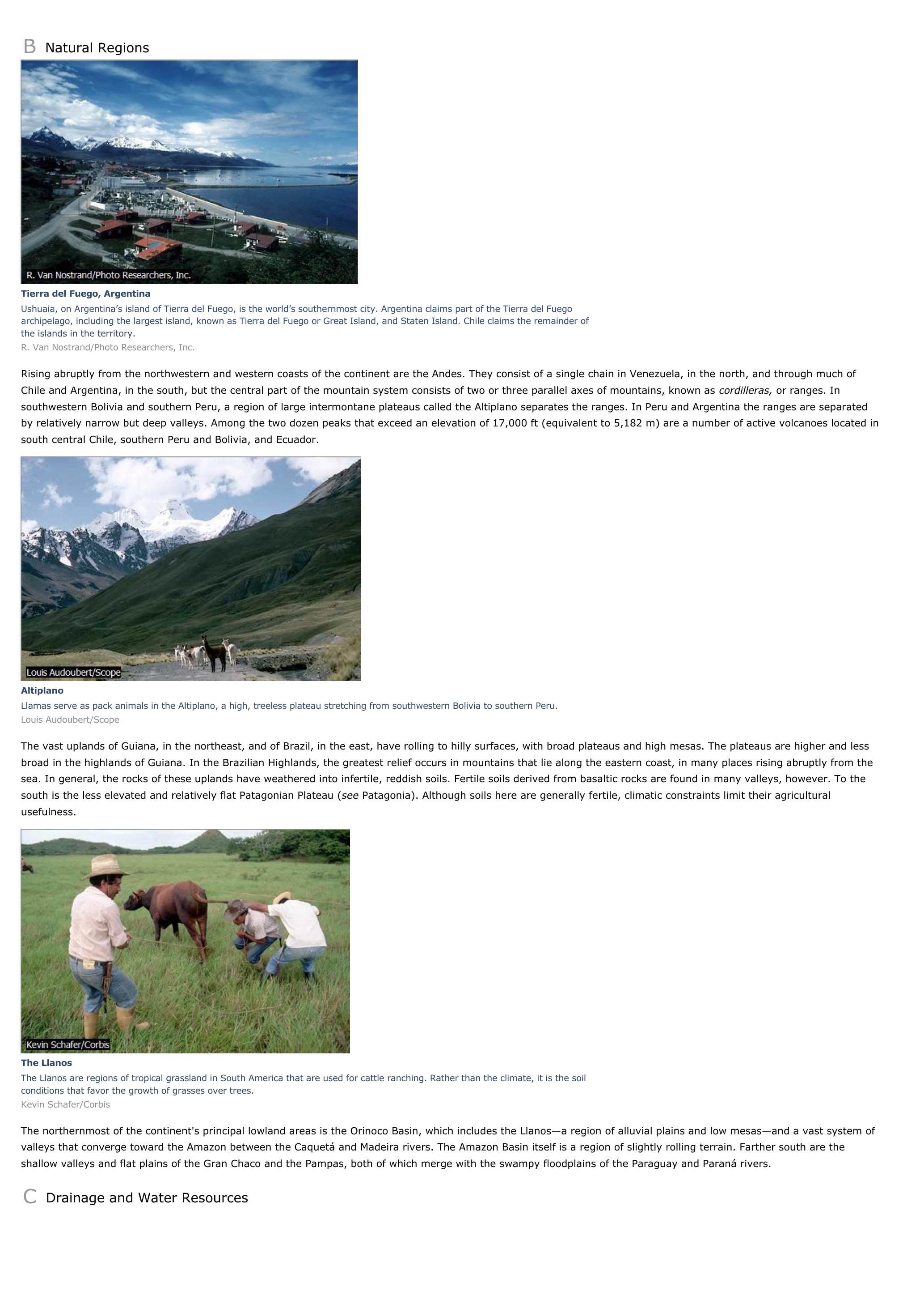
« B Natural Regions Tierra del Fuego, ArgentinaUshuaia, on Argentina’s island of Tierra del Fuego, is the world’s southernmost city.

Argentina claims part of the Tierra del Fuegoarchipelago, including the largest island, known as Tierra del Fuego or Great Island, and Staten Island.

Chile claims the remainder ofthe islands in the territory.R.

Van Nostrand/Photo Researchers, Inc. Rising abruptly from the northwestern and western coasts of the continent are the Andes.

They consist of a single chain in Venezuela, in the north, and through much ofChile and Argentina, in the south, but the central part of the mountain system consists of two or three parallel axes of mountains, known as cordilleras, or ranges.

In southwestern Bolivia and southern Peru, a region of large intermontane plateaus called the Altiplano separates the ranges.

In Peru and Argentina the ranges are separatedby relatively narrow but deep valleys.

Among the two dozen peaks that exceed an elevation of 17,000 ft (equivalent to 5,182 m) are a number of active volcanoes located insouth central Chile, southern Peru and Bolivia, and Ecuador. AltiplanoLlamas serve as pack animals in the Altiplano, a high, treeless plateau stretching from southwestern Bolivia to southern Peru.Louis Audoubert/Scope The vast uplands of Guiana, in the northeast, and of Brazil, in the east, have rolling to hilly surfaces, with broad plateaus and high mesas.

The plateaus are higher and lessbroad in the highlands of Guiana.

In the Brazilian Highlands, the greatest relief occurs in mountains that lie along the eastern coast, in many places rising abruptly from thesea.

In general, the rocks of these uplands have weathered into infertile, reddish soils.

Fertile soils derived from basaltic rocks are found in many valleys, however.

To thesouth is the less elevated and relatively flat Patagonian Plateau ( see Patagonia).

Although soils here are generally fertile, climatic constraints limit their agricultural usefulness. The LlanosThe Llanos are regions of tropical grassland in South America that are used for cattle ranching.

Rather than the climate, it is the soilconditions that favor the growth of grasses over trees.Kevin Schafer/Corbis The northernmost of the continent's principal lowland areas is the Orinoco Basin, which includes the Llanos—a region of alluvial plains and low mesas—and a vast system ofvalleys that converge toward the Amazon between the Caquetá and Madeira rivers.

The Amazon Basin itself is a region of slightly rolling terrain.

Farther south are theshallow valleys and flat plains of the Gran Chaco and the Pampas, both of which merge with the swampy floodplains of the Paraguay and Paraná rivers. C Drainage and Water Resources. »

↓↓↓ APERÇU DU DOCUMENT ↓↓↓

Liens utiles