Silk Road - history.
Publié le 26/05/2013

Extrait du document
«
Takla Makan DesertTravelers on the Silk Road had to cross the Takla Makan desert, a bleak region of drifting sand dunes in northwestern China.
Mostcaravans, using camels like these for transport, traveled along the edges of the desert, at the base of the mountain ranges thatsurround it.AFP/Corbis
The Silk Road consisted of several principal routes.
The different routes developed in response to environmental obstacles and changing political circumstances.
All caravans traveling from east to west left from Chang’an (modern Xi’an) in northern China.
They traveled along the Hexi Corridor (in modern Gansu province) betweenthe Gobi Desert to the north and the Nan Shan mountains to the south.
At Jiayuguan the caravans left the protection of the wall along China’s northern border (rebuiltcenturies later as the network of walls known as the Great Wall) and headed for Anxi.
The first major obstacle along the route was the inhospitable Takla Makan desert, which lay just beyond Anxi.
Here, some travelers continued south, while others wentnorth.
The southern route passed through Dunhuang, an oasis town that later emerged as a center of Buddhist learning and art.
At Dunhuang the path diverged again, onefork skirting the Takla Makan to the south and the other to the north.
The southern fork entered the Tarim Pendi (the basin of the Tarim River) and then skirted the northernflank of the Kunlun Mountains.
Travelers rested at Hotan, an oasis town that became an important jade center.
The caravans then continued along the Kunlun to the town ofKashi (Kashgar), in the foothills of the Pamirs mountain range, where they rejoined travelers who circumvented the Takla Makan via the northern fork.
The longer and more circuitous northern route from Anxi detoured sharply north along the fringes of a desolate sector of the desert.
Once a caravan had reached Hami,however, it had completed the most arduous and perilous leg of the journey.
The caravan then followed the southern foothills of the Tian Shan mountains via the towns ofTurpan and Yanqi.
The northern route met up with the northern fork of the southern route at Korla before reaching Kashi.
The route from Kashi to western Asia varied considerably as new towns and empires waxed and waned during the approximately 1,500 years of trade along the Silk Road.All travelers, however, had to cross one of the rugged mountain ranges that stretch across Central Asia.
One route headed west to cross the Tian Shan mountains,descending to Samarqand and Bukhara (both in present-day Uzbekistan).
This route then crossed the Amu Darya river and continued to Merv (present-day Mary,Turkmenistan).
The other route ran south through the high Pamirs to Bactra (now Balkh, Afghanistan) before winding its way to Merv.
From Merv, travelers journeyed toNishapur (now Neyshābū r, Iran).
Then, passing south of the Caspian Sea, some continued west to Palmyra and the Mediterranean Sea, while others headed north forByzantium (later Constantinople; now İstanbul, Turkey).
In later periods, the Persian cities of Tabr īz, Sh īr ā z, and E şfah ān became vital political centers.
As such, these citieswere important destinations for the merchants plying the Silk Road.
Few caravans or merchants traveled the whole distance from Chang’an to western Asia.
Goods were traded all along the route, and new caravans would be organized totransmit the cargo to the next commercial emporium.
Oases, with supplies of food, water, and fresh horses and camels, were vital for the smooth operation of the SilkRoad.
Multiethnic local residents who spoke many different languages provided a valuable service, promoting communication and trade with the traveling caravans.
CentralAsians and Persians served as the principal traders on the route because Chinese rulers generally prohibited their own merchants from traveling abroad.
IV CARAVANS AND TRADE
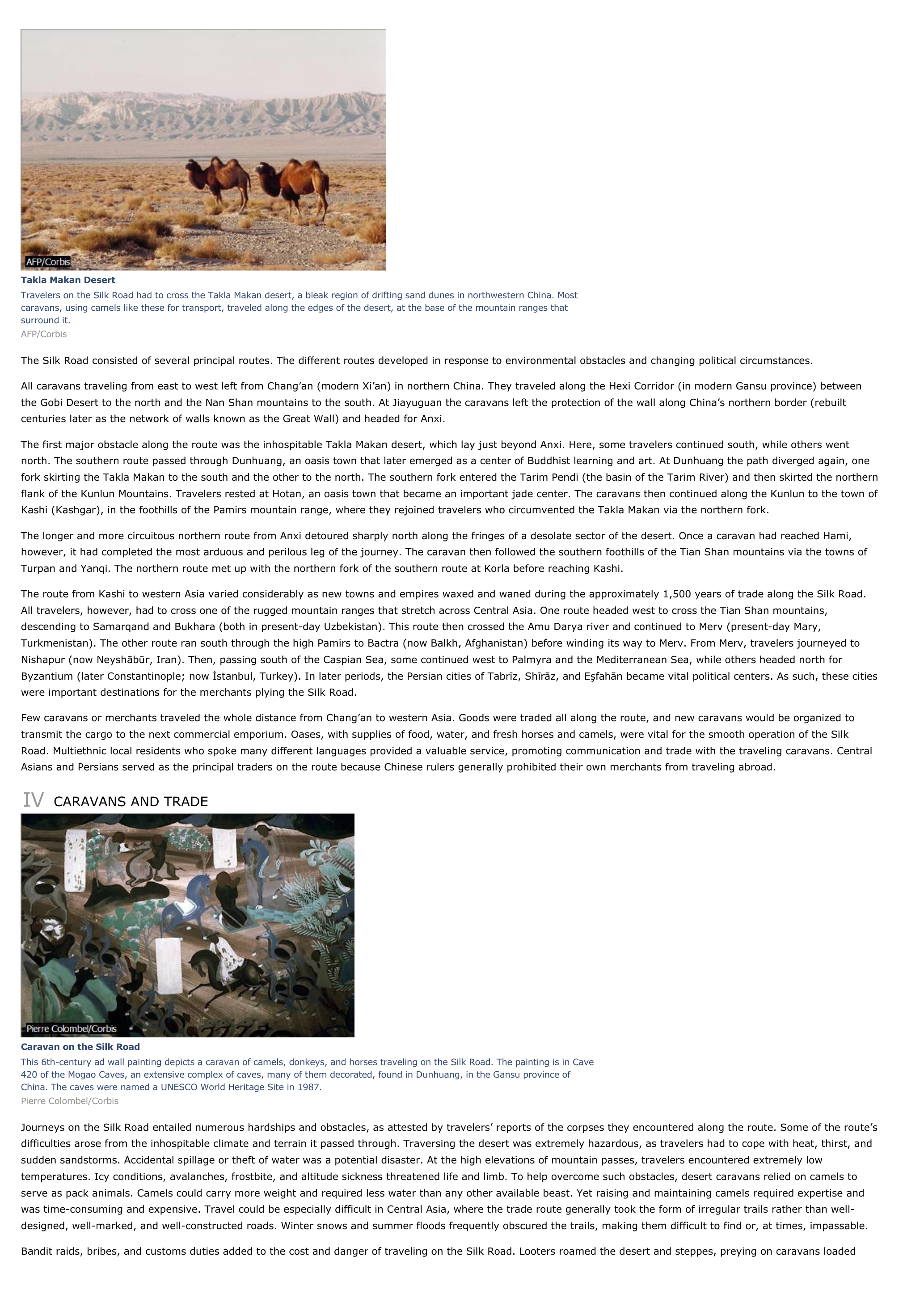
Caravan on the Silk RoadThis 6th-century ad wall painting depicts a caravan of camels, donkeys, and horses traveling on the Silk Road.
The painting is in Cave420 of the Mogao Caves, an extensive complex of caves, many of them decorated, found in Dunhuang, in the Gansu province ofChina.
The caves were named a UNESCO World Heritage Site in 1987.Pierre Colombel/Corbis
Journeys on the Silk Road entailed numerous hardships and obstacles, as attested by travelers’ reports of the corpses they encountered along the route.
Some of the route’sdifficulties arose from the inhospitable climate and terrain it passed through.
Traversing the desert was extremely hazardous, as travelers had to cope with heat, thirst, andsudden sandstorms.
Accidental spillage or theft of water was a potential disaster.
At the high elevations of mountain passes, travelers encountered extremely lowtemperatures.
Icy conditions, avalanches, frostbite, and altitude sickness threatened life and limb.
To help overcome such obstacles, desert caravans relied on camels toserve as pack animals.
Camels could carry more weight and required less water than any other available beast.
Yet raising and maintaining camels required expertise andwas time-consuming and expensive.
Travel could be especially difficult in Central Asia, where the trade route generally took the form of irregular trails rather than well-designed, well-marked, and well-constructed roads.
Winter snows and summer floods frequently obscured the trails, making them difficult to find or, at times, impassable.
Bandit raids, bribes, and customs duties added to the cost and danger of traveling on the Silk Road.
Looters roamed the desert and steppes, preying on caravans loaded.
»
↓↓↓ APERÇU DU DOCUMENT ↓↓↓
Liens utiles
- Silk Road - History.
- Ideology and Rationality in the History of the Life Sciences
- HISTOIRE DU RÈGNE DE L'EMPEREUR CHARLES-QUINT [The History of the Reign of the Emperor Charles V].
- On the road
- HISTOIRE DU MONDE [History of the World].


